Broadacres Farms
I come from a family of farmers. Growing up in Terre Haute, Indiana - along the banks of the Wabash river, we spent a lot of time at various farms owned by various family members.
The most significant to me is what is known today as Broadacres Farms. This land spans a massive amount (>600?) of acreage between the Wabash River and Highway 41 in North Terre Haute, near the unincorporated Spelterville area.
In 2022, the land is made up of both conservation wetlands, wooded area, levee, and tillable acres. The current state is less interesting than the history. Growing up spending a lot of time on the land, I certainly didn’t appreciate it as much as I do now. I learn more and more about the history and become even more fascinated.
Land Makeup
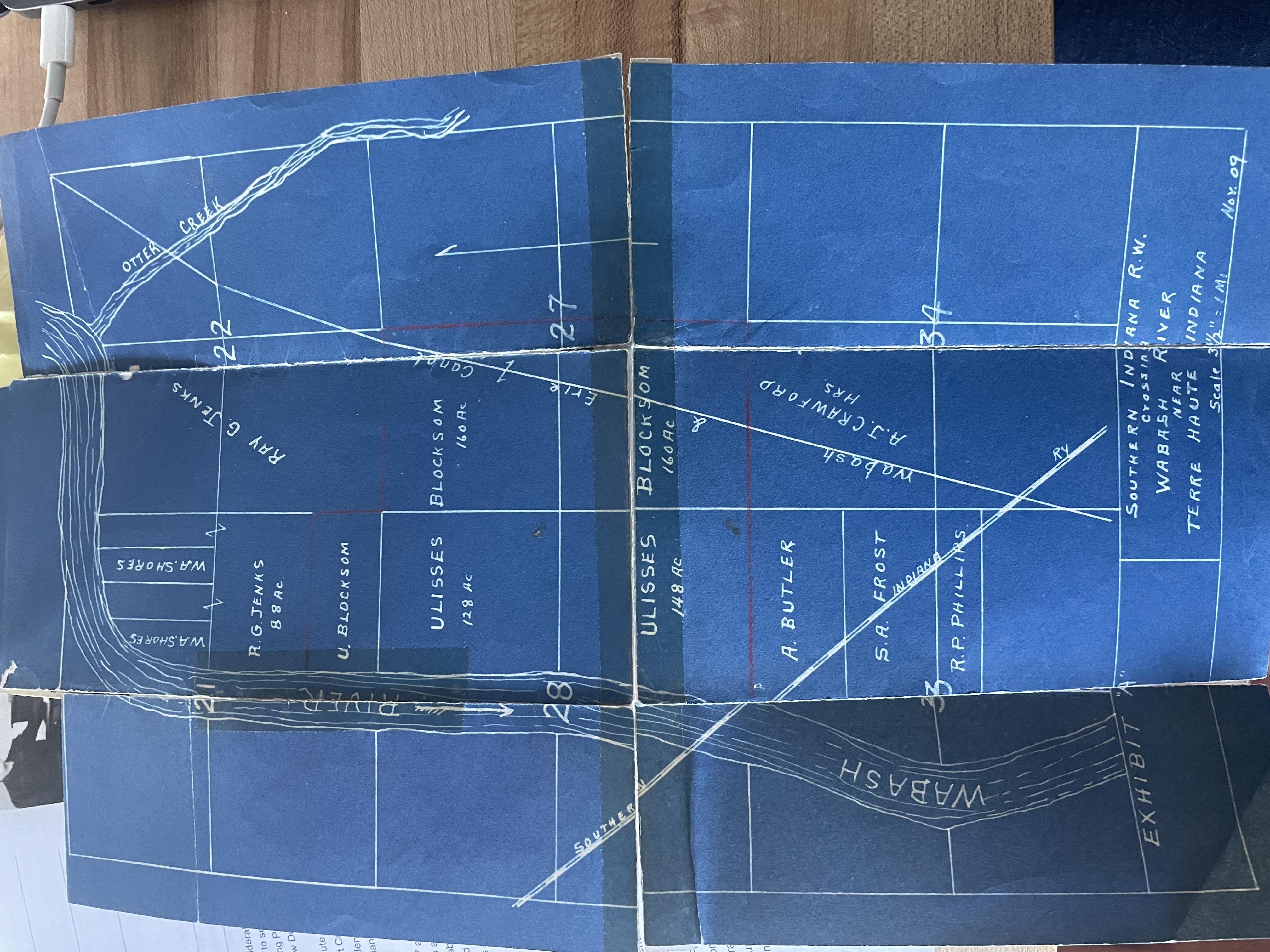
An early map of the land from 1909 shows names of some of the original owners. I see a Catherine M. McBride and T. Benjamin BcMride had some ownership in the late 1880s, which is the farthest back record in my possession.
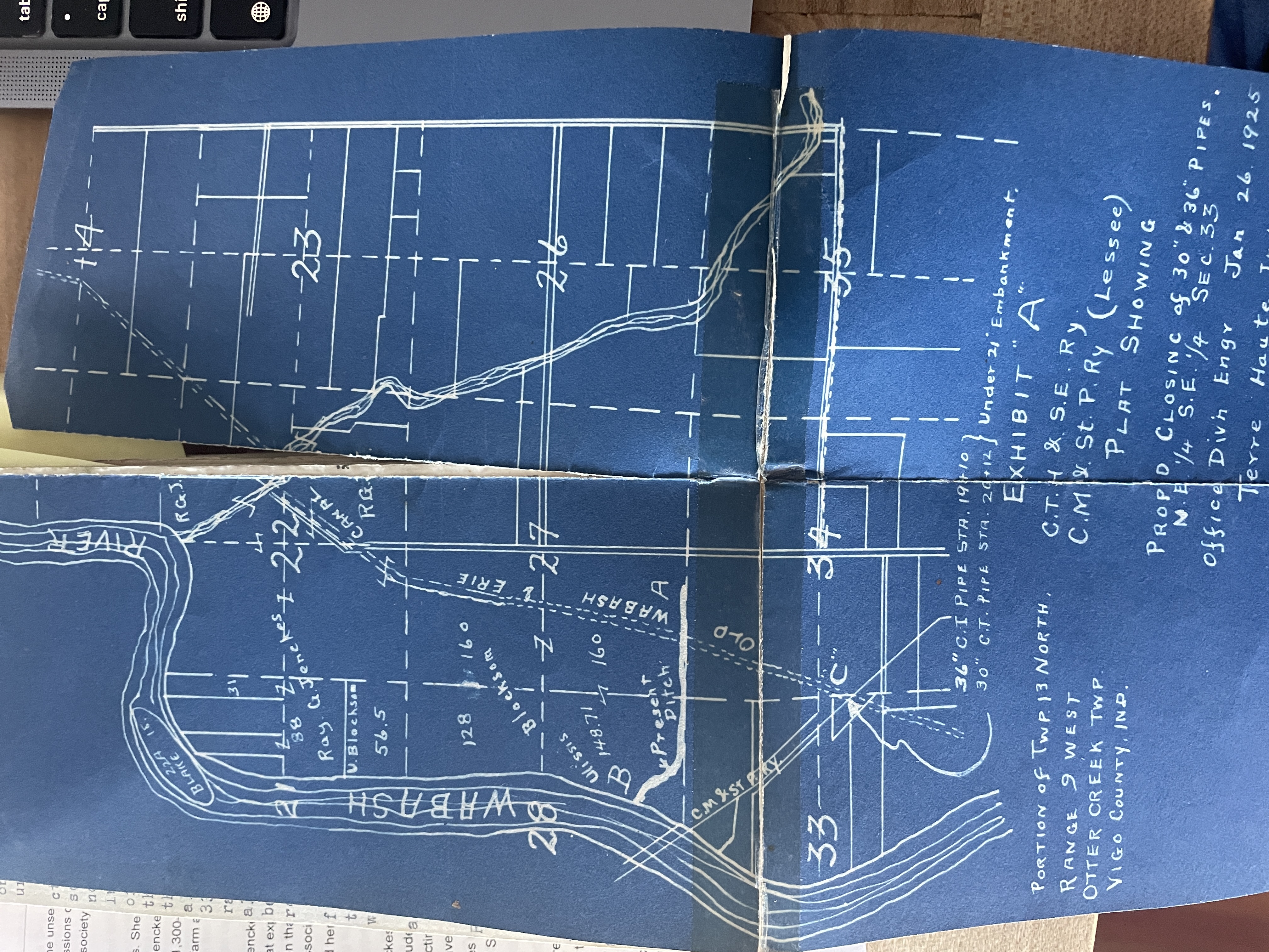
And a 1925 version shows some slight differences.
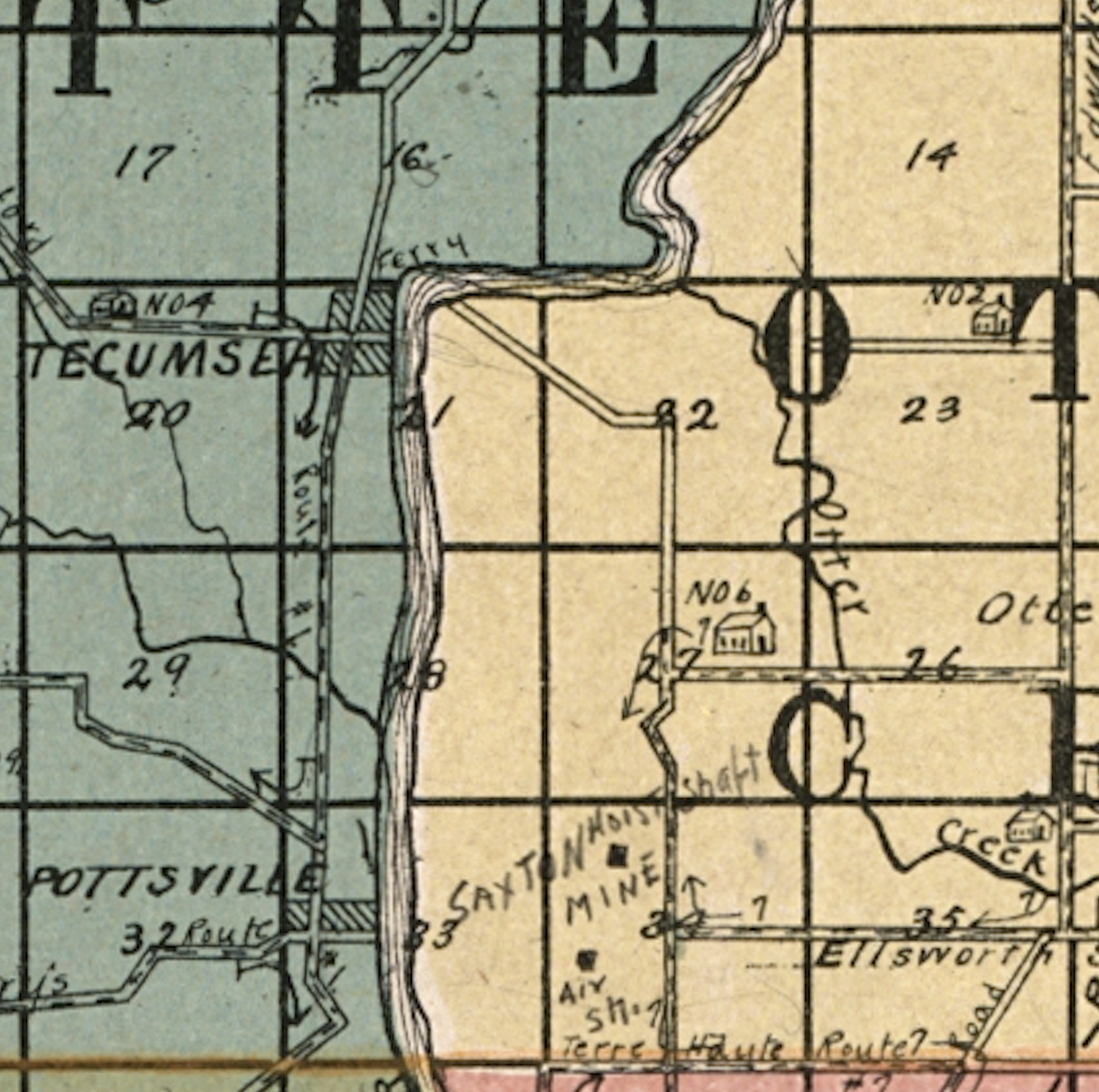
An early section map
Getting the Land
According to abstract 122470, deed record 240, page 408, Ivy Blocksom, widow deceased William F. Blocksom, conveyed the property to my great grandparents, Joseph and Maude Dunlap and sibling Frank and Ella Welsh. This deed was signed by parties April 30, 1946. Conveyed Property:
- 56 1/2 acres off of the south side of the south half of the east fractional section 21, township 13 north, range 9 west.
- West half of section 27, township 13 north, range 9 west, containing 320 acres more or less
- The east fractional section 28, township 13 north, range 9 west
- Subject to the rights conveyed to the Shell Petroleum Corporation by the Blocksoms in Deed Record 210, page 576
- Subject to the partition line established by agreement executed by the Blocksoms and Grasselli Chemical Company dated May 15, 1924 and recorded in Misc. Record 46, page 508.
- Execpted the coal and other mineral rights pertaining as conveyed by Ulysses Blocksom to Harry Sherburn by deed dated Nov 8 1915 and recorded in Deed Record 145, page 30.
The land has since been reconveyed and inherited via different lineages since.
Levee
The river bottom land abuts the Wabash river for a number of miles. There is a very high and strong levee that was constructed to protect the land from flooding. I never knew anythinga about this levee until recently, I learned of its history. The land was at one point owned by congresswoman Virginia Jenckes, and she became a major proponent in flood control as a founder of the Wabash and Maumee Valley Improvement Association.
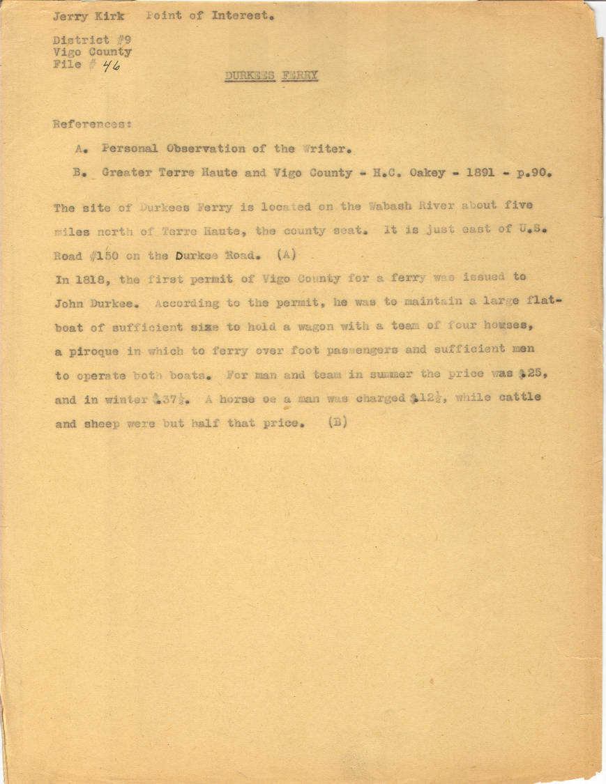
Durkees Ferry
If you visit the un-incorporated town of New Goshen Indiana, you’ll stumble upon Durkees Ferry Road. It turns out, this ferry actually crossed the river on Broadacres Farmland.
Wabash and Eric Canal
The Wabash and Eric Canal once ran through the land, as highlighted on some of the maps above. You can see actual physical remnants of it even to this day on the land itself.
To learn more, we visited the current canal museum in Delphi, Indiana.